Approximate Location Map
Large Map »
Latitude: 52.2023 / 52°12'8"N
Longitude: 0.1184 / 0°7'6"E
OS Eastings: 544864
OS Northings: 258120
OS Grid: TL448581
Mapcode National: GBR L79.SWT
Mapcode Global: VHHK3.0XF3
Plus Code: 9F426429+W9
Entry Name: 4, Botolph Lane
Listing Date: 2 November 1972
Grade: II
Source: Historic England
Source ID: 1331838
English Heritage Legacy ID: 47346
ID on this website: 101331838
Location: Cambridge, Cambridgeshire, CB2
County: Cambridgeshire
District: Cambridge
Electoral Ward/Division: Market
Parish: Non Civil Parish
Built-Up Area: Cambridge
Traditional County: Cambridgeshire
Lieutenancy Area (Ceremonial County): Cambridgeshire
Church of England Parish: Cambridge St Botolph
Church of England Diocese: Ely
Tagged with: Building
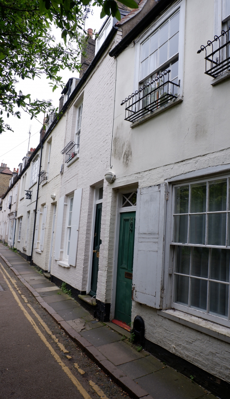
BOTOLPH LANE
1.
942
(South Side)
No 4
TL 4458 SE 6/30
II GV
2.
Late C18/Early C19. Brick, rendered on upper floor. 2 storeys and attic.
2 windows, sashes with glazing bars. Tiled roof, one dormer window.
All the listed buildings in Botolph Lane form a group.
Listing NGR: TL4486458119
External links are from the relevant listing authority and, where applicable, Wikidata. Wikidata IDs may be related buildings as well as this specific building. If you want to add or update a link, you will need to do so by editing the Wikidata entry.


Other nearby listed buildings
