Latitude: 52.3994 / 52°23'57"N
Longitude: 0.2612 / 0°15'40"E
OS Eastings: 553937
OS Northings: 280333
OS Grid: TL539803
Mapcode National: GBR M6H.DW7
Mapcode Global: VHHJ6.GYYJ
Plus Code: 9F4297X6+PF
Entry Name: The Chantry
Listing Date: 23 September 1950
Grade: II*
Source: Historic England
Source ID: 1126493
English Heritage Legacy ID: 48766
ID on this website: 101126493
Location: Ely, East Cambridgeshire, CB7
County: Cambridgeshire
District: East Cambridgeshire
Civil Parish: Ely
Built-Up Area: Ely
Traditional County: Cambridgeshire
Lieutenancy Area (Ceremonial County): Cambridgeshire
Church of England Parish: Ely
Church of England Diocese: Ely
Tagged with: Architectural structure
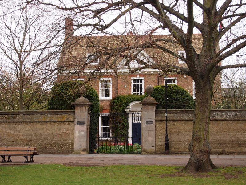
1. PALACE GREEN 1082 TL 5380 1/59 23.9.50. The Chantry II* GV 2. A C18 brick house (local bricks) with a modillioned wood eaves cornice. 2 storeys and attics. The centre part of 1 window range breaks forward slightly, surmounted by a modillion pediment. A red brick band runs between the storeys. 5 window range, double-hung sashes with glazing bars, in flush cased frames. The windows have red brick gauged arches. The west end has 2 window range and a 2 storey wing extends at the rear with a 2 window range. A central doorway has a domed hood on enriched console brackets. Roof tiled, old Cambridgeshire tiles, with stopped gables and 2 flat headed dormers.
The Chantrey, the Walls & Gates to The Chantry, No 3, wall and railings to No 3 frm a group with Bishop's Palace, the College and The Cathedral of The Holy Trinity.
Listing NGR: TL5393780333
External links are from the relevant listing authority and, where applicable, Wikidata. Wikidata IDs may be related buildings as well as this specific building. If you want to add or update a link, you will need to do so by editing the Wikidata entry.


Other nearby listed buildings