Latitude: 52.1704 / 52°10'13"N
Longitude: -2.2424 / 2°14'32"W
OS Eastings: 383520
OS Northings: 252491
OS Grid: SO835524
Mapcode National: GBR 1G9.XKG
Mapcode Global: VH92T.2QX0
Plus Code: 9C4V5QC5+53
Entry Name: Powick Old Bridge
Listing Date: 22 May 1954
Last Amended: 12 June 2001
Grade: I
Source: Historic England
Source ID: 1390030
English Heritage Legacy ID: 488981
Also known as: Powick Bridge
ID on this website: 101390030
Location: Lower Wick, Worcester, Worcestershire, WR2
County: Worcestershire
District: Worcester
Electoral Ward/Division: Bedwardine
Parish: Non Civil Parish
Built-Up Area: Worcester
Traditional County: Worcestershire
Lieutenancy Area (Ceremonial County): Worcestershire
Church of England Parish: St John in Bedwardine
Church of England Diocese: Worcester
Tagged with: Road bridge
This asset was previously listed twice also at List Entry 1349275. That entry was removed from the List on 29 August 2024.
This entry was subject to a Minor Amendment on 29 August 2024 to remove references to the duplicate list entry, to replace numerals with words and to reformat to current standards. The GIS triangle depiction was moved slightly from SO8352052490 to SO8351252471. Thus placing it on the parish boundary between Powick, Malvern Hills and Worcester non-civil parish area which passes through the building.
WORCESTER
SO85SW
620-1/3/681
OLD ROAD, Lower Wick
Powick Old Bridge
Formerly Listed as: LOWER WICK Powick Old Bridge (that part in the City of Worcester))
22/05/54
GV
I
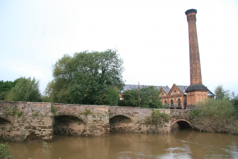
Bridge over River Teme and Laughern Brook. C16 with later restorations. Sandstone ashlar, part restored in red brick, with pinkish-brown brick and ashlar copings. Five arches, three with skew segmental arches and cutwaters with pedestrian refuges, two round arches. Surmounted by balustrade approximately 1 metre high. Plaque records: POWICK BRIDGE / RIVER TEME / DURING THE ENGLISH CIVIL WARS BETWEEN ROYALISTS AND PARLIAMENTARIANS / THE FIRST SKIRMISH ON 23.9.1642 / AND THE LAST MAJOR BATTLE ON 3.9.1651 / TOOK PLACE ON AND NEAR THIS HISTORIC BRIDGE. Now by-passed by bridge of 1837. The two northern-piers of the bridge were destroyed by the Royalists in 1651.
External links are from the relevant listing authority and, where applicable, Wikidata. Wikidata IDs may be related buildings as well as this specific building. If you want to add or update a link, you will need to do so by editing the Wikidata entry.


Other nearby listed buildings