Approximate Location Map
Large Map »
Latitude: 52.3304 / 52°19'49"N
Longitude: -0.0311 / 0°1'51"W
OS Eastings: 534264
OS Northings: 272082
OS Grid: TL342720
Mapcode National: GBR K46.YRS
Mapcode Global: VHGLZ.DPYC
Plus Code: 9C4X8XJ9+5H
Entry Name: Lock Up
Listing Date: 16 August 1971
Grade: II
Source: Historic England
Source ID: 1128459
English Heritage Legacy ID: 54043
ID on this website: 101128459
Location: Needingworth, Huntingdonshire, Cambridgeshire, PE27
County: Cambridgeshire
District: Huntingdonshire
Civil Parish: Holywell-cum-Needingworth
Built-Up Area: Needingworth
Traditional County: Huntingdonshire
Lieutenancy Area (Ceremonial County): Cambridgeshire
Church of England Parish: Holywell St John the Baptist
Church of England Diocese: Ely
Tagged with: Architectural structure
HOLYWELL-CUM-NEEDINGWORTH HIGH STREET
1.
5140
(south-east side)
Needingworth
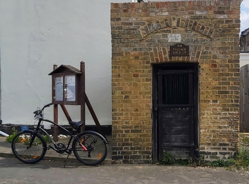
TL 37 SW 7/46 16.8.71 Lock-up
II GV
2.
Lock-up dated 1838 on stone plaque. Gault brick, cat-slide slate roof. Oak plank
door with original iron grill and hinges.
Listing NGR: TL3426472082
External links are from the relevant listing authority and, where applicable, Wikidata. Wikidata IDs may be related buildings as well as this specific building. If you want to add or update a link, you will need to do so by editing the Wikidata entry.


Other nearby listed buildings
