Approximate Location Map
Large Map »
Latitude: 54.6225 / 54°37'21"N
Longitude: -1.3854 / 1°23'7"W
OS Eastings: 439781
OS Northings: 525435
OS Grid: NZ397254
Mapcode National: GBR LGRZ.VR
Mapcode Global: WHD6Q.P2HN
Plus Code: 9C6WJJF7+2R
Entry Name: Ruins of a Church of St Thomas a Becket
Listing Date: 16 November 1967
Grade: I
Source: Historic England
Source ID: 1329821
English Heritage Legacy ID: 59263
Also known as: St Thomas a Becket's Church
ID on this website: 101329821
Location: Grindon, Stockton-on-Tees, North Yorkshire, TS21
County: Stockton-on-Tees
Civil Parish: Grindon
Traditional County: Durham
Lieutenancy Area (Ceremonial County): County Durham
Church of England Parish: Stockton Country Parish
Church of England Diocese: Durham
Tagged with: Church ruin
NZ 32 NE GRINDON DURHAM ROAD (off)
(East side)
1/500 Ruins of Church of
St Thomas A Becket
16.11.67
1
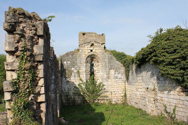
Ashlar nave of late C12 with south doorway, lancets and C13 east window. Rubble
chancel possibly earlier but little detail remains. South chapel walls with
piscina. Base of south porch walls.
Listing NGR: NZ3977925431
External links are from the relevant listing authority and, where applicable, Wikidata. Wikidata IDs may be related buildings as well as this specific building. If you want to add or update a link, you will need to do so by editing the Wikidata entry.


