Latitude: 50.5174 / 50°31'2"N
Longitude: -4.8348 / 4°50'5"W
OS Eastings: 199131
OS Northings: 72464
OS Grid: SW991724
Mapcode National: GBR ZT.9KBF
Mapcode Global: FRA 07RP.J8Q
Plus Code: 9C2QG588+X3
Entry Name: Wadebridge Bridge
Listing Date: 6 June 1969
Grade: II*
Source: Historic England
Source ID: 1142975
English Heritage Legacy ID: 67879
Also known as: Late medieval and 19th century bridge at Wadebridge
ID on this website: 101142975
Location: Wadebridge, Cornwall, PL27
County: Cornwall
Civil Parish: Wadebridge
Built-Up Area: Wadebridge
Traditional County: Cornwall
Lieutenancy Area (Ceremonial County): Cornwall
Church of England Parish: St Breoke
Church of England Diocese: Truro
Tagged with: Road bridge
WADEBRIDGE WADEBRIDGE SW 9872-9972 9/253 Wadebridge Bridge 6.6.69
GV II*
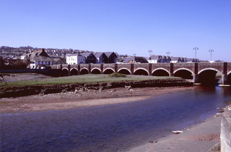
Road bridge over River Camel. Circa 1468, financed by Thomas Lovybound vicar of Egloshayle. Widened in 1847 and again in 1963, the consultant engineers Posford, Parry and Partners. Local stone rubble. Granite dressings used in the alterations of 1847 and 1963. The bridge, 320 feet long, originally had 17 arches, 12 of which visibly survive; the end arches having been built up and were used as cellars. The original pointed arches are 18 feet 6 inches wide and rise some 9 feet from the springing point. The piers are 12 feet wide with deep cutwaters between each arch, rising to form refuges in the parapets. In 1847 granite segmental arches were inserted across the cutwaters to widen the carriageway by 3 feet on either side, thereby diminishing the depth of the cutwaters. In 1963 the bridge was widened on the south east side, almost doubling the original width of the bridge. The design of the granite segmental arches of the 1847 widening was copied using rusticated granite blocks with cutwaters repeated, rising to form refuges. The bridge was mentioned by William of Worcester in his visit of 1478 and a detailed account is given by Leland (1538). The bridge originally connected 2 chapels on either side of the river, one dedicated to St Michael and the other known as King's Chapel, both of which have been demolished. Local legend states that Lovybound, patron of the bridge, was unsure how to build foundations on a river bed; however, after a dream about sheep shearing he set bales of wool on the river bed, which in time swole up and bound the shifting mud, thereby allowing secure foundations to be laid. Henderson, C and Coates, H Old Cornish Bridges and Streams, 1928, reprinted 1972 Polsue, J Lake's Parochial History of the County of Cornwall, 1872 reprinted 1974 Country Life 7 Jan 1965
Listing NGR: SW9913172464
External links are from the relevant listing authority and, where applicable, Wikidata. Wikidata IDs may be related buildings as well as this specific building. If you want to add or update a link, you will need to do so by editing the Wikidata entry.


Other nearby listed buildings