Latitude: 54.3389 / 54°20'20"N
Longitude: -2.7483 / 2°44'54"W
OS Eastings: 351442
OS Northings: 493963
OS Grid: SD514939
Mapcode National: GBR 9L78.SD
Mapcode Global: WH82W.R6GK
Plus Code: 9C6V87Q2+HM
Entry Name: 109, Burneside Road
Listing Date: 17 February 1975
Last Amended: 30 January 1985
Grade: II
Source: Historic England
Source ID: 1318976
English Heritage Legacy ID: 75359
ID on this website: 101318976
Location: Kentrigg, Westmorland and Furness, Cumbria, LA9
County: Westmorland and Furness
District: South Lakeland
Civil Parish: Kendal
Built-Up Area: Kendal
Traditional County: Westmorland
Lieutenancy Area (Ceremonial County): Cumbria
Church of England Parish: Burneside St Oswald
Church of England Diocese: Carlisle
Tagged with: Building
SD 59 SW (INSET) KENDAL BURNESIDE ROAD (East side) 2/17 No 109 (formerly listed as Aikrigg End) 17-2-75 II
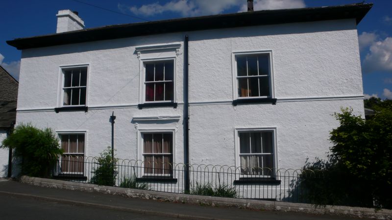
House. Late C18/early C19 rebuild; later additions and alterations. Wet-dashed rubble with 1st floor sill band to roadside elevation. Moulded cast-iron gutter on dentils. Hipped, graduated slate roof with full-height, gabled porch projecting on south elevation. Stone mid and end chimneys. 2 storeys. South elevation 3 bays (2:1). Panelled door between sashes, all in corniced, pilastered surround; sash above. Central paired sash in single-storey bay window to left, 2 sashes above. Roadside elevation symmetrical, 3 bays. 3 sashes, with glazing bars, in architraves, to each floor; bracketed cornice to central window on each floor.
Listing NGR: SD5144293963
External links are from the relevant listing authority and, where applicable, Wikidata. Wikidata IDs may be related buildings as well as this specific building. If you want to add or update a link, you will need to do so by editing the Wikidata entry.


Other nearby listed buildings