Latitude: 54.2066 / 54°12'23"N
Longitude: -3.1411 / 3°8'27"W
OS Eastings: 325669
OS Northings: 479589
OS Grid: SD256795
Mapcode National: GBR 6MHS.RS
Mapcode Global: WH724.QJFG
Plus Code: 9C6R6V45+MH
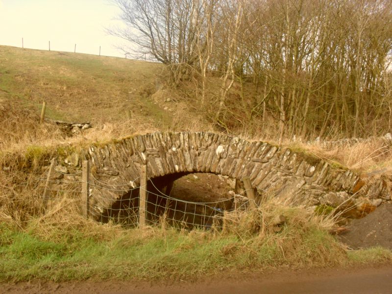
Entry Name: Devils Bridge
Listing Date: 25 March 1970
Grade: II
Source: Historic England
Source ID: 1311386
English Heritage Legacy ID: 75879
ID on this website: 101311386
Location: Westmorland and Furness, Cumbria, LA12
County: Westmorland and Furness
District: South Lakeland
Civil Parish: Pennington
Traditional County: Lancashire
Lieutenancy Area (Ceremonial County): Cumbria
Church of England Parish: Pennington St Michael and the Holy Angels
Church of England Diocese: Carlisle
SD 27 NE,
16/105
PENNINGTON,
Devils Bridge
25.03.70
II
Packhorse bridge to north-west side of road. C17 or C18. Stone rubble.
Segmental arch with thin voussoirs of varying lengths. Low parapet of upright
stones. 2m wide.
Listing NGR: SD2566979589