Latitude: 54.221 / 54°13'15"N
Longitude: -3.2725 / 3°16'21"W
OS Eastings: 317127
OS Northings: 481333
OS Grid: SD171813
Mapcode National: GBR 5MLM.9N
Mapcode Global: WH722.P5VG
Plus Code: 9C6R6PCG+9X
Entry Name: Millom Castle
Listing Date: 8 September 1967
Grade: I
Source: Historic England
Source ID: 1086619
English Heritage Legacy ID: 76333
ID on this website: 101086619
Location: Cumberland, Cumbria, LA18
County: Cumberland
District: Copeland
Civil Parish: Millom
Traditional County: Cumberland
Lieutenancy Area (Ceremonial County): Cumbria
Church of England Parish: Millom
Church of England Diocese: Carlisle
Tagged with: Castle
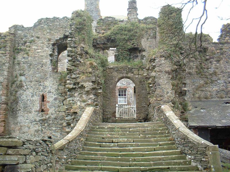
MILLOM A5093 SD 18 SE (south side) 15/33 Millom Castle 8.9.67 - I Ruins of castle or moated manor house incorporating present farmhouse. Licence to crenellate 1335, east range later C14, great tower, now farmhouse C16 or Cl7 with later alterations. Stone rubble with ashlar dressings, house partly roughcast with parallel hipped slate roofs. House has hall to north; east range has central gatehouse, kitchen range to north, solar range to south. Windows with pointed heads. East elevation has projecting gatehouse up C17 steps, front wall collapsed, small projection to south. Straight-headed 1st floor window to south return. South elevation of house has varied windows with label moulds, mostly tall 12-pane sashes, later 2-storey wing to west. Cross-axial stack and return lateral stacks. Entrance to wing. West elevation has pointed entrance and window opening to hall, entrance with overlight and 2 sashed windows to house, gabled out-house to wing which has sashed windows. North elevation has later barns abutting. Solar range has 1st floor with larger windows and ogee-headed entrance, probably to garderobe, to south-west angle; ground floor fireplace has smoke hole to outer hall with finial. Gatehouse has signs of 1st floor, small courtyard to west has jamb of entrance with portcullis groove. Kitchen range has segmental-headed fireplace with smoke hole to outer wall. 2 pointed entrances to hall lwhich has signs of east dais and 2 formerly Y tracery north windows. House north elevation has 2 pointed entrances to vaulted cellars; sashed windows, one with bull's eye pane. East elevation has wide-boarded studded door. Moat to west and north. Scheduled Ancient Monument. See T Clare: 'Guide to Archaeological Sites of Cumbria'.
Listing NGR: SD1713181336
External links are from the relevant listing authority and, where applicable, Wikidata. Wikidata IDs may be related buildings as well as this specific building. If you want to add or update a link, you will need to do so by editing the Wikidata entry.


Other nearby listed buildings