Approximate Location Map
Large Map »
Latitude: 54.1996 / 54°11'58"N
Longitude: -2.9497 / 2°56'58"W
OS Eastings: 338142
OS Northings: 478620
OS Grid: SD381786
Mapcode National: GBR 7MVW.6B
Mapcode Global: WH83C.NPLW
Plus Code: 9C6V53X2+R4
Entry Name: Pump Opposite End of the Causeway
Listing Date: 15 February 1989
Grade: II
Source: Historic England
Source ID: 1087182
English Heritage Legacy ID: 76939
ID on this website: 101087182
Location: Cartmel, Westmorland and Furness, Cumbria, LA11
County: Cumbria
District: South Lakeland
Civil Parish: Lower Allithwaite
Traditional County: Lancashire
Lieutenancy Area (Ceremonial County): Cumbria
Church of England Parish: Cartmel St Mary and St Michael
Church of England Diocese: Carlisle
Tagged with: Building
LOWER ALLITHWAITE AYNSOME ROAD
SD 3878
(East side) Cartmel
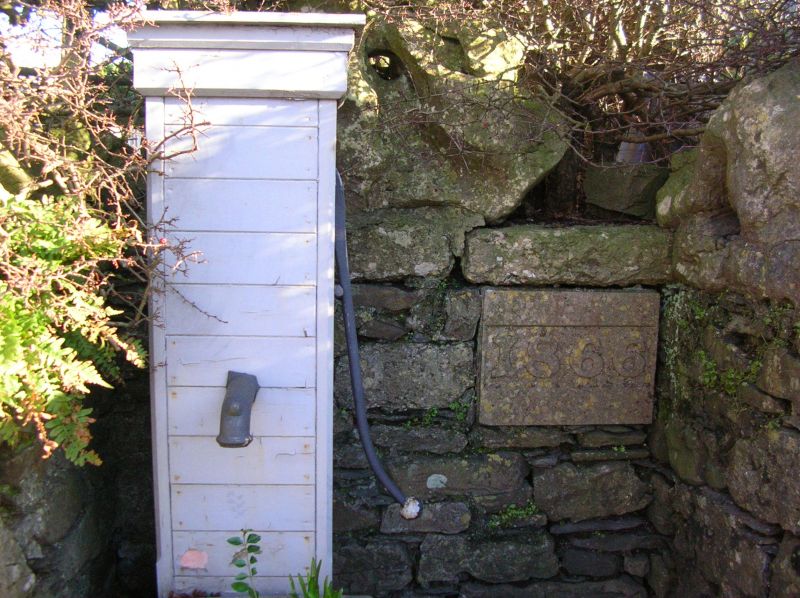
8/28 Pump opposite end of
The Causeway
II
Pump in stone-walled recess. Datestone: 1866. Pump in timber casing with spout
and handle. Stone trough and step. Datestone in back wall of recess. 3 large
waterworn limestone blocks to tops of walls.
Listing NGR: SD3814278620
External links are from the relevant listing authority and, where applicable, Wikidata. Wikidata IDs may be related buildings as well as this specific building. If you want to add or update a link, you will need to do so by editing the Wikidata entry.


Other nearby listed buildings
