Latitude: 54.8698 / 54°52'11"N
Longitude: -2.8521 / 2°51'7"W
OS Eastings: 345410
OS Northings: 553116
OS Grid: NY454531
Mapcode National: GBR 8DJ4.93
Mapcode Global: WH804.5V3L
Plus Code: 9C6VV49X+W4
Entry Name: Cumwhinton Station
Listing Date: 9 March 1984
Grade: II
Source: Historic England
Source ID: 1335564
English Heritage Legacy ID: 77780
ID on this website: 101335564
Location: Wetheral Pasture, Cumberland, Cumbria, CA4
County: Cumberland
District: Carlisle
Civil Parish: Wetheral
Built-Up Area: Cumwhinton
Traditional County: Cumberland
Lieutenancy Area (Ceremonial County): Cumbria
Church of England Parish: Scotby and Cotehill with Cumwhinton
Church of England Diocese: Carlisle
Tagged with: Architectural structure Station building
WETHERAL B 6263 CUMWHINTON
Cumwhinton Station
GV II
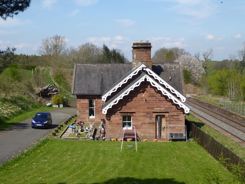
Railway Station (disused). 1875. Red sandstone ashlar with slate roofs. The main building is on the downside. Single storey. Central booking office with glazed front flanked by gables with three light sash windows. Further bay with lower roof line at each end,two light window. Elaborate pierced bargeboards to all gables. Ashlar stacks with weathering. Upside retains its small shelter in similar style. Constructed for the Settle-Carlisle line of the Midland Railway and although closed remains unaltered and little damaged.
Listing NGR: NY4541053116
External links are from the relevant listing authority and, where applicable, Wikidata. Wikidata IDs may be related buildings as well as this specific building. If you want to add or update a link, you will need to do so by editing the Wikidata entry.


Other nearby listed buildings