Approximate Location Map
Large Map »
Latitude: 50.7715 / 50°46'17"N
Longitude: -3.0615 / 3°3'41"W
OS Eastings: 325244
OS Northings: 97412
OS Grid: SY252974
Mapcode National: GBR PF.CLZM
Mapcode Global: FRA 47G1.R3M
Plus Code: 9C2RQWCQ+HC
Entry Name: Old Shute House
Listing Date: 14 December 1955
Last Amended: 19 October 1984
Grade: I
Source: Historic England
Source ID: 1171033
English Heritage Legacy ID: 88159
ID on this website: 101171033
Location: Shute, East Devon, EX13
County: Devon
District: East Devon
Civil Parish: Shute
Traditional County: Devon
Lieutenancy Area (Ceremonial County): Devon
Church of England Parish: Shute St Michael
Church of England Diocese: Exeter
Tagged with: English country house
SY 29 NE SHUTE SHUTE VILLAGE
10/482
14.12.55 Old Shute House,
previously listed as
"Shute Barton"
GV
I
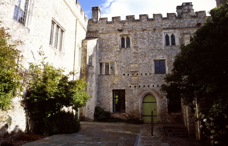
Survival of a substantial medieval manor house. Built partly circa 1380 by Sir
William Bonville, Sheriff of Dorset, Somerset and Devon. The extensions of late C15
by the Greys, the Marquesses of Dorset and of the late C16 were largely demolished
in 1785 when Sir John Pole built Shute House qv.
Large stone rubble house with slate roofs and embattled parapets. U-shaped on plan
arranged around a courtyard. Three and two storey ranges. The original south east
wing of circa 1380 has the kitchen on the ground floor with hall above. The north
east wing is of circa late C15 with a polygonal stair turret at the north end and
buttressed on the north east side when extensions were demolished in 1785. The
south west two storey gatehouse wing was built or much altered in C15 and forms the
third side of the courtyard. The square tower on the south east side of the
southeast wing is probably part of the late C15 additions, although the windows are
C16 and C17. Most of the other windows are of C15, C16 and C17.
Interior: south east wing: first floor hall roof has arched braces to collar beams
and curved wind braces. The hall floor has been raised and an extra storey
inserted. Newel-stair to hall in angle turret in courtyard. Kitchen has great
hearth at south end and C15 screen. North east wing contains fine panelled first
floor room of circa 1660 with a contemporary chimneypiece and large cupboard.
Reference: Country Life Volume 109, pages 326 and 398.
Listing NGR: SY2524497410
External links are from the relevant listing authority and, where applicable, Wikidata. Wikidata IDs may be related buildings as well as this specific building. If you want to add or update a link, you will need to do so by editing the Wikidata entry.


Other nearby listed buildings
