Latitude: 50.6939 / 50°41'38"N
Longitude: -3.1293 / 3°7'45"W
OS Eastings: 320328
OS Northings: 88860
OS Grid: SY203888
Mapcode National: GBR PC.SSQL
Mapcode Global: FRA 47B7.NPM
Plus Code: 9C2RMVVC+H7
Entry Name: The Masons Arms
Listing Date: 11 February 1985
Grade: II
Source: Historic England
Source ID: 1309319
English Heritage Legacy ID: 88717
ID on this website: 101309319
Location: Branscombe, East Devon, EX12
County: Devon
District: East Devon
Civil Parish: Branscombe
Traditional County: Devon
Lieutenancy Area (Ceremonial County): Devon
Church of England Parish: Branscombe St Winifred
Church of England Diocese: Exeter
Tagged with: Pub Thatched pub
SY 28 NW BRANSCOMBE THE SQUARE, Vicarage
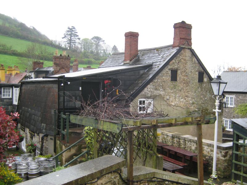
8/45 The Masons Arms - 11.2.85 - II Public House. C17 origins, much altered in the C19 and C20. Exposed local stone rubble; stone rubble stacks topped with C19 and C20 brick; slate roof, most, if not all, was formerly thatch. Plan: 4-room plan public house and restaurant facing south. In fact there were once more rooms but internal walls have been knocked out to create more floor space. The roofline appears to define 3 adjoining front blocks built in a line and it is easy to interpret these as formerly three 2-room plan cottages which have been joined together to make up the present premises. The left hand (western) block has a gable-end stack and an axial stack backing onto the left end room. The centre block has an axial stack backing onto the right end block and that right block has a gable-end stack. No obvious butt joins show between these blocks and there is some evidence of C17 or maybe early C18 work in all three. The C20 alterations to make former cottages into the present public house have done much to confound evidence of earlier layouts and structural development. There are various C19 and C20 service extensions to rear. The main block and some of the rear extensions are 2 storeys. Exterior: overall irregular 7-window front of C20 casements with glazing bars. Each block had a roughly central doorway. The left one is disused behind a stone rubble porch with thatch roof. The centre one contains a late C19 9-panel door and the right one contains a late C19 - early C20 plank door under a C20 hood which is carried round a former woodshed. The roof is gable-ended. It steps down from the left block to the centre, then changes pitch from the centre to the right block. Interior: is mostly the result of C19 and C20 modernisations. There are some neatly chamfered ground floor beams which may be C17 but not all are in situ. The bar (the inside room of the left block) has the only fireplace which is definitely C17; it is stone with a chamfered and scroll-stopped oak lintel. The roof was not inspected.
Listing NGR: SY2032888860
External links are from the relevant listing authority and, where applicable, Wikidata. Wikidata IDs may be related buildings as well as this specific building. If you want to add or update a link, you will need to do so by editing the Wikidata entry.


Other nearby listed buildings