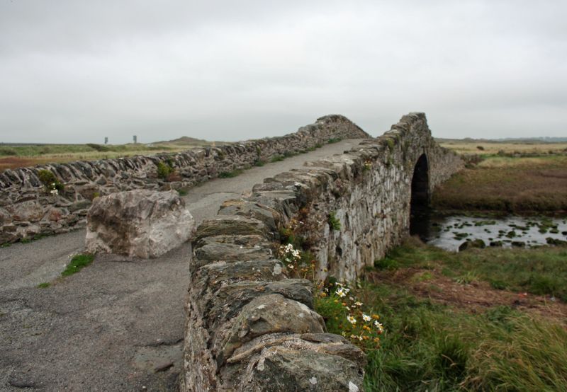
Pont Aberffraw
A Grade II Listed Building in Aberffraw, Isle of Anglesey
Coordinates
Latitude: 53.1921 / 53°11'31"N
Longitude: -4.4625 / 4°27'45"W
OS Eastings: 235578
OS Northings: 368947
OS Grid: SH355689
Mapcode National: GBR 58.2VVJ
Mapcode Global: WH434.F165
Plus Code: 9C5Q5GRP+VX
Entry Name: Pont Aberffraw
Listing Date: 1 August 1952
Grade: II
Source: Cadw
Source ID: 5259
Building Class: Transport
ID on this website: 300005259
Location: Spanning the Afon Ffraw at the eastern side of Aberffraw, the bridge is located at the E end of Bridge Street.
County: Isle of Anglesey
Community: Aberffraw
Community: Aberffraw
Traditional County: Anglesey
Tagged with:
Bridge
History
Built in 1731; constructed with money donated by Sir Arthur Owen, Bart., of Bodeon (Bodowen). The bridge has been blocked to traffic since the new road bridge spanning the Afon Ffraw was built in recent years; now in use as a foot bridge over the river.
Exterior
A single span, hump-backed bridge of rubble masonry with segmental arch of dressed voussoirs, with keystone, slightly inset below extrados course of narrow slabs. Long approaches with rough parapets.
Reasons for Listing
Listed as an excellent and well documented example of a C18 roadbridge, which forms an important part of the landscape and character of the village of Aberffraw.
External Links
External links are from the relevant listing authority and, where applicable, Wikidata.
Wikidata IDs may be related buildings as well as this specific building. If you want to add or update a link, you
will need to do so by editing the Wikidata entry.
Recommended Books
Other nearby listed buildings
-
II
Seion Methodist Chapel, including railings to forecourt
Set back slightly, within an enclosed oval yard, from the SE side of the junction of Bridge Street with Bodorgan Square, c. 200m NE of the church of St. Beuno in Aberffraw.
-
II
The Eagles
Located on the E side of Church Street, just S of Bodorgan Square and c.125m NE of the Church of St. Beuno in Aberffraw.
-
II
Aberffraw Calvinistic Methodist Chapel
Slightly set back from the W side of Chapel Street, with an enclosed yard to front (N), and c. 225m NNE of the church of St. Beuno, Aberffraw. The chapel house and earlier schoolroom range is directl
-
II
Aberffraw Calvinistic Methodist Schoolroom and Chapel House
With entrances leading directly onto W side of Chapel Street, the schoolroom lies directly N of the adjacent Calvinistic Methodist Chapel (the chapel house abutting the S end of the schoolroom range),
-
II
Pendref
Located at the SW end of Church Street, c. 25m NE of the church of St. Beuno in Aberffraw.
-
II*
Church of St. Beuno
Located within an enclosed churchyard, set back from the S side of Church Street, in the SW part of Aberffraw.
-
II
Llwynisgaw
In a rural location set back from the SE side of a country road, running between Hermon and Aberffraw S of the A4080; c. 2km SW of the church of St. Cadwaladr.
-
II
Treberfedd
In an isolated rural location set well back from the W side of a country road, running between Hermon and Aberffraw S of the A4080; c. 2km SW of the church of St. Cadwaladr.