Approximate Location Map
Large Map »
Latitude: 53.1651 / 53°9'54"N
Longitude: -3.1267 / 3°7'36"W
OS Eastings: 324769
OS Northings: 363697
OS Grid: SJ247636
Mapcode National: GBR 70.4NYS
Mapcode Global: WH775.YP7Y
Plus Code: 9C5R5V8F+28
Entry Name: Pen-y-Bont Farmhouse
Listing Date: 15 June 1988
Last Amended: 15 June 1988
Grade: II
Source: Cadw
Source ID: 576
Building Class: Domestic
ID on this website: 300000576
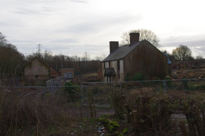
Location: Situated alongside the river Alyn and reached by a track from the west end of the bridge at Pentre.
County: Flintshire
Community: Argoed
Community: Argoed
Built-Up Area: Mold
Traditional County: Flintshire
Tagged with: Farmhouse
In origin a row of C17/C18 single storey cottages converted to 2 storey farmhouse in early C19. Ground floor of random uncoursed rubble with later brick first storey and stacks set forward of the ridge. Slate roof. 4 bays, 1st floor, shallow upper sash to 12 pane windows. 16 pane sashes to ground floor. Plain reveals, stone lintels and sills. Good C19 gabled open timber porch, bargeboards and slate roof; panelled door.
External links are from the relevant listing authority and, where applicable, Wikidata. Wikidata IDs may be related buildings as well as this specific building. If you want to add or update a link, you will need to do so by editing the Wikidata entry.


Other nearby listed buildings
