Approximate Location Map
Large Map »
Latitude: 53.3778 / 53°22'40"N
Longitude: -2.0018 / 2°0'6"W
OS Eastings: 399976
OS Northings: 386776
OS Grid: SJ999867
Mapcode National: GBR GYGC.DV
Mapcode Global: WHBB5.7C0B
Plus Code: 9C5V9XHX+47
Entry Name: Barn at Whitle Farm (Occupied by D Stafford)
Listing Date: 19 September 1977
Grade: II
Source: Historic England
Source ID: 1054715
English Heritage Legacy ID: 81868
ID on this website: 101054715
Location: Hidebank, High Peak, Derbyshire, SK22
County: Derbyshire
District: High Peak
Civil Parish: New Mills
Traditional County: Derbyshire
Lieutenancy Area (Ceremonial County): Derbyshire
Church of England Parish: New Mills St George
Church of England Diocese: Derby
Tagged with: Barn
NEW MILLS WHITLE BANK ROAD
1.
5172
(North Side)
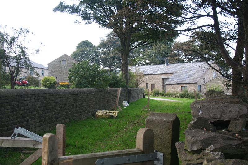
Barn at Whitle Farm
(occupied by D Stafford)
SJ 98 NE 2/53A
II GV
2.
Barn dated 1671 in coursed stone with Welsh slate roof. Dated on door lintel.
A later cart entry and penticed extension to right.
Listing NGR: SJ9997686776
External links are from the relevant listing authority and, where applicable, Wikidata. Wikidata IDs may be related buildings as well as this specific building. If you want to add or update a link, you will need to do so by editing the Wikidata entry.


Other nearby listed buildings
