Approximate Location Map
Large Map »
Latitude: 53.3773 / 53°22'38"N
Longitude: -2.0023 / 2°0'8"W
OS Eastings: 399942
OS Northings: 386717
OS Grid: SJ999867
Mapcode National: GBR GYGD.91
Mapcode Global: WHBB5.6CRQ
Plus Code: 9C5V9XGX+W3
Entry Name: Bower House
Listing Date: 19 September 1977
Grade: II
Source: Historic England
Source ID: 1088127
English Heritage Legacy ID: 81862
ID on this website: 101088127
Location: Hidebank, High Peak, Derbyshire, SK22
County: Derbyshire
District: High Peak
Civil Parish: New Mills
Traditional County: Derbyshire
Lieutenancy Area (Ceremonial County): Derbyshire
Church of England Parish: New Mills St George
Church of England Diocese: Derby
Tagged with: House
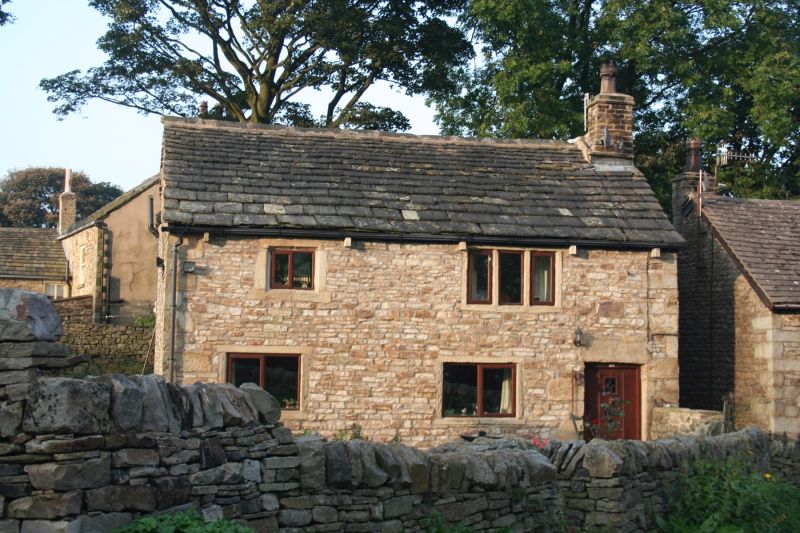
NEW MILLS WHITLE BANK ROAD
1.
5172
(North Side)
Bower House
SJ 98 NE 2/51
II GV
2.
C17 or early C18 cottage of 2 storeys, painted white and rendered with stone slate
roof with 1 stack. 1 window in chamfered stone surround and 1 window of 3 lights
with stone mullions. 1 window to ground floor with wood mullion. Plain door.
Listing NGR: SJ9994286717
External links are from the relevant listing authority and, where applicable, Wikidata. Wikidata IDs may be related buildings as well as this specific building. If you want to add or update a link, you will need to do so by editing the Wikidata entry.


Other nearby listed buildings
