Approximate Location Map
Large Map »
Latitude: 53.3431 / 53°20'35"N
Longitude: -2.2774 / 2°16'38"W
OS Eastings: 381627
OS Northings: 382946
OS Grid: SJ816829
Mapcode National: GBR DYJS.R9
Mapcode Global: WH992.Z7PG
Plus Code: 9C5V8PVF+62
Entry Name: Oversleyford Bridge at Ngr 81628294
Listing Date: 6 July 1984
Grade: II
Source: Historic England
Source ID: 1237972
English Heritage Legacy ID: 415325
ID on this website: 101237972
Location: Morley, Cheshire East, Cheshire, SK9
County: Cheshire East
Civil Parish: Wilmslow
Traditional County: Cheshire
Lieutenancy Area (Ceremonial County): Cheshire
Church of England Parish: Wilmslow St Bartholomew
Church of England Diocese: Chester
Tagged with: Bridge
SJ 88 SW
1/312
WILMSLOW FORMER U.D.
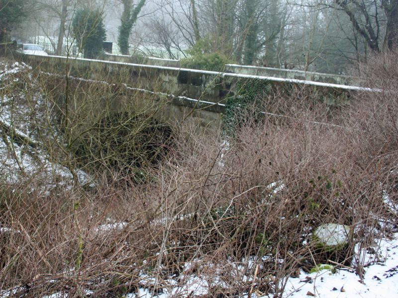
Oversleyford Bridge at NGR 81628294
II
Bridge over River Bollin: late C18/early C19 Ashlar buff sandstone. Broad
segmental arch sprung from low piers has raised band at road level and plain
parapet with a rounded coping.
Listing NGR: SJ8162782946
External links are from the relevant listing authority and, where applicable, Wikidata. Wikidata IDs may be related buildings as well as this specific building. If you want to add or update a link, you will need to do so by editing the Wikidata entry.


Other nearby listed buildings
