Approximate Location Map
Large Map »
Latitude: 51.4215 / 51°25'17"N
Longitude: -1.7303 / 1°43'49"W
OS Eastings: 418848
OS Northings: 169197
OS Grid: SU188691
Mapcode National: GBR 4X2.TLB
Mapcode Global: VHB46.YJMN
Plus Code: 9C3WC7C9+HV
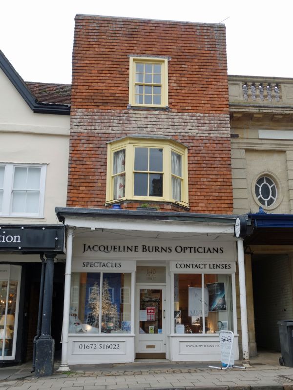
Entry Name: 141, High Street
Listing Date: 21 October 1974
Grade: II
Source: Historic England
Source ID: 1258313
English Heritage Legacy ID: 310387
ID on this website: 101258313
Location: Marlborough, Wiltshire, SN8
County: Wiltshire
Civil Parish: Marlborough
Built-Up Area: Marlborough
Traditional County: Wiltshire
Lieutenancy Area (Ceremonial County): Wiltshire
Tagged with: Building
HIGH STREET
1.
5407
(North Side)
No 141
SU 1869 1/200
II GV
2.
Probably C16 originally, altered Cl8 and Cl9. 3 storey. Tile hung, 1 window
on 2nd floor, C19 angular bay window on 1st floor and C19 shop front. Cl7 timber
framed wing to rear.
Nos 131 to 144 (consec) and Midland Bank form a group, with the Town Hall and
Nos 1 to 12 (consec), opposite.
Listing NGR: SU1884269213
External links are from the relevant listing authority and, where applicable, Wikidata. Wikidata IDs may be related buildings as well as this specific building. If you want to add or update a link, you will need to do so by editing the Wikidata entry.


Other nearby listed buildings
