Approximate Location Map
Large Map »
Latitude: 52.9189 / 52°55'8"N
Longitude: -1.4787 / 1°28'43"W
OS Eastings: 435147
OS Northings: 335852
OS Grid: SK351358
Mapcode National: GBR PJG.YZ
Mapcode Global: WHDGT.8W3N
Plus Code: 9C4WWG9C+HG
Entry Name: 73, Wilson Street
Listing Date: 24 February 1977
Grade: II
Source: Historic England
Source ID: 1278704
English Heritage Legacy ID: 404731
ID on this website: 101278704
Location: The Holmes, Derby, Derbyshire, DE1
County: City of Derby
Electoral Ward/Division: Arboretum
Parish: Non Civil Parish
Built-Up Area: Derby
Traditional County: Derbyshire
Lieutenancy Area (Ceremonial County): Derbyshire
Church of England Parish: Derby St Peter and Christ Church with Holy Trinity
Church of England Diocese: Derby
Tagged with: Building
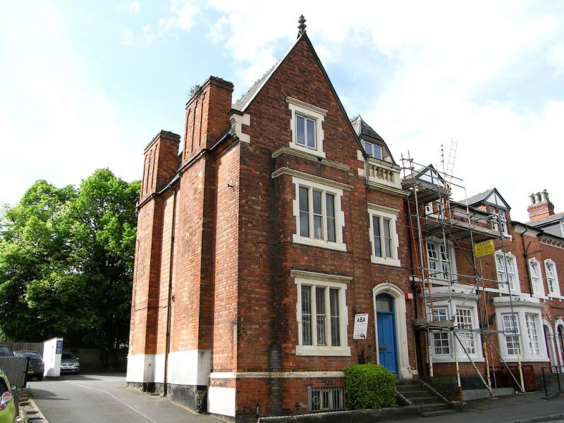
WILSON STREET
1.
5170
No 73
SK 3535 6/319
II GV
2.
Late C19. Brick with stone dressings; 2 storeys with attics in gables; 4 gables;
5 windows in keyed stone surrounds with semi-circular headed lights; altered doorway
with steps up; slates.
No 75 forms a group with Nos 110 to 122 (even) Green Lane.
Listing NGR: SK3514735852
External links are from the relevant listing authority and, where applicable, Wikidata. Wikidata IDs may be related buildings as well as this specific building. If you want to add or update a link, you will need to do so by editing the Wikidata entry.


Other nearby listed buildings
