History in Structure

Parish Boundary Stone on Dam Wall at SJ 9329 7372

A Grade II Listed Building in Higher Hurdsfield, Cheshire East

(Area of) Parish Boundary Stone on Dam Wall at SJ 9329 7372

Uploader's Comments

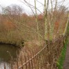
Despite a public footpath running alongside the area where the boundary stone is likely to be is overgrown and out of bounds. The vegetation is very thick with dead brambles (March 2024) and would in any case to impossible to see in the summer. The current parish boundary runs along the public footpath but the historic NLS map shows the parish boudnary as running through the reservoir.

Uploaded by Colin Park on 18 March 2024

https://disqus.com/by/disqus_nrXkHoeQ1p/

Photo ID: 356949
Building ID: 101329936
Report this photo

Photo Navigator

BritishListedBuildings.co.uk is an independent online resource and is not associated with any government department. All government data published here is used under licence. Please do not contact BritishListedBuildings.co.uk for any queries related to any individual listed building, planning permission related to listed buildings or the listing process itself.

British Listed Buildings is a Good Stuff website.