Latitude: 54.0381 / 54°2'17"N
Longitude: -1.6415 / 1°38'29"W
OS Eastings: 423573
OS Northings: 460294
OS Grid: SE235602
Mapcode National: GBR JPZR.D6
Mapcode Global: WHC85.RRHP
Plus Code: 9C6W29Q5+69
Entry Name: New Bridge
Listing Date: 6 March 1967
Grade: II
Source: Historic England
Source ID: 1150597
English Heritage Legacy ID: 331149
ID on this website: 101150597
Location: Birstwith, North Yorkshire, HG3
County: North Yorkshire
District: Harrogate
Civil Parish: Birstwith
Traditional County: Yorkshire
Lieutenancy Area (Ceremonial County): North Yorkshire
Church of England Parish: Birstwith St James
Church of England Diocese: Leeds
BIRSTWITH DARLEY ROAD SE 26 SW (north side, off)
9/21 New Bridge 6.3.67 GV II
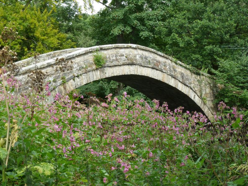
Bridge over River Nidd. 1822, possibly reusing earlier materials. Coursed squared gritstone, of sandy texture on north-west (upstream) side and harder greyer stone on south-east; paved with river cobbles. A single high round arch carries the 2-metre wide causeway over a span of approximately 20 metres. Voussoirs and projecting band, rounded parapet coping; the parapet terminates in square bollards with pyramidal caps. At each end the width of the path is narrowed by a pair of stone bollards approximately 60 centimetres high, rounded and with grooved surfaces. 2 iron loops are built into the parapet outer surface on the upstream side. A stone stile is built into the parapet wall, south-west end. The bridge stands on the pack- horse track from Otley to Ripon. The earlier single-span bridge which stood about 25 yards upstream was demolished in 1822; it is likely that this bridge has reused stone from it and is of a similar style. A Scheduled Ancient Monument. H Speight, Nidderdale, 1894, p 398.
Listing NGR: SE2357360293


Other nearby listed buildings