Approximate Location Map
Large Map »
Latitude: 51.5914 / 51°35'29"N
Longitude: -2.3895 / 2°23'22"W
OS Eastings: 373114
OS Northings: 188134
OS Grid: ST731881
Mapcode National: GBR 0MY.2PT
Mapcode Global: VH95M.J8MC
Plus Code: 9C3VHJR6+H6
Entry Name: Sturt Bridge at National Grid Reference St 7313 8812
Listing Date: 5 June 1984
Grade: II
Source: Historic England
Source ID: 1128749
English Heritage Legacy ID: 34835
ID on this website: 101128749
Location: Wickwar, South Gloucestershire, GL12
County: South Gloucestershire
Civil Parish: Wickwar
Built-Up Area: Wickwar
Traditional County: Gloucestershire
Lieutenancy Area (Ceremonial County): Gloucestershire
Church of England Parish: Hawkesbury St Mary
Church of England Diocese: Gloucester
Tagged with: Bridge Packhorse bridge
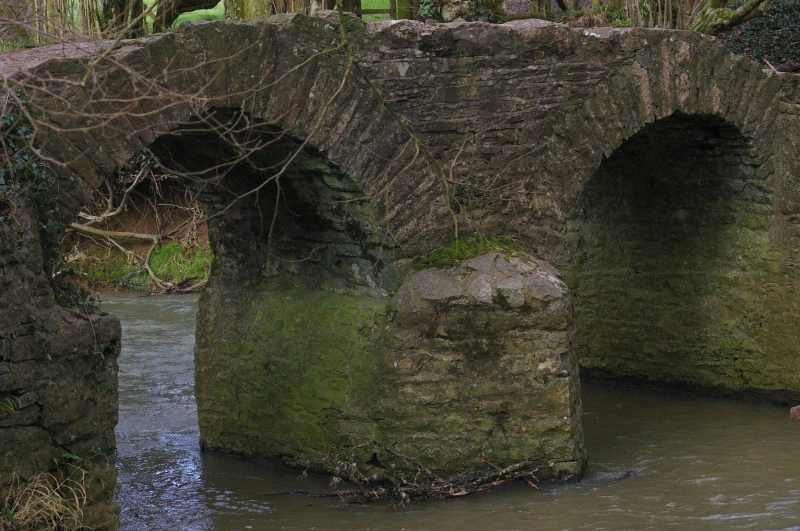
ST 78 NW WICKWAR
4/211 Sturt Bridge at NGR ST 7313
8812
- II
Packhorse Bridge. Probably late mediaeval or C16/C17. Rubble bridge of two
arches, the west one is slightly pointed; central cutwaters, no parapet.
Listing NGR: ST7311488134
External links are from the relevant listing authority and, where applicable, Wikidata. Wikidata IDs may be related buildings as well as this specific building. If you want to add or update a link, you will need to do so by editing the Wikidata entry.


Other nearby listed buildings
